Hamirpur, one of the twelve districts of beautiful state Himachal Pradesh, lies in the middle of the state. The most literate district and well connected by roads from all sides, shares its geographical boundaries with Bilaspur, Mandi, Kangra and Una districts. District is situated between 76-17-50 to 76-43-42 east longitudes and 31-24-48 to 31-53-35 north latitudes. Tract is hilly covered by Shivalik Range. The elevation varies from 400 meters to 1100 meters. Majority of the people serve in the defence services thus popularly known as Veer Bhoomi and also widely famous for Child-Saint Shrine Baba Balak Nath
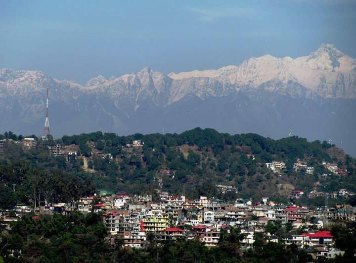 The main hill ranges of the district are known as Jakh
Dhar & Sola Singhi Dhar. The Jakh dhar runs in continuation of Kali Dhar range in the Kangra district. It enters in Hamirpur
district near Nadaun and transverses it into southeastern direction. The town of Hamirpur lies to the east of this range where
the country is undulating but in the north and north east bare and rugged hills, deep ravines with precipitous sides
transform the landscape into what has been described as an agitated sea suddenly arrested and fixed stones.
The Chabutra hills have the same dip and strike as in the Jakh Dhar and are continued beyond the Beas to what is known as the Changar,
a mass of rugged and broken hills. The Sola Singhi Dhar is the longest range of the tract and is known under various
names such as Chintpurni and Jaswan Dhar in Una and by Sola Singhi in Hamirpur. Thus Dhar enters Hamirpur to the east of Tappa
Daruhi and traverses it in a south-easterly direction more or less parallel to the Jakh Dhar and terminated on the Satluj.
Hamirpur district is bounded in the north by river Beas which separates it from Kangra district. In the east Bakar and Seer Khads
separate it from Mandi district. In the south, It is bounded by Bilaspur district and in the west by Una district.
The main hill ranges of the district are known as Jakh
Dhar & Sola Singhi Dhar. The Jakh dhar runs in continuation of Kali Dhar range in the Kangra district. It enters in Hamirpur
district near Nadaun and transverses it into southeastern direction. The town of Hamirpur lies to the east of this range where
the country is undulating but in the north and north east bare and rugged hills, deep ravines with precipitous sides
transform the landscape into what has been described as an agitated sea suddenly arrested and fixed stones.
The Chabutra hills have the same dip and strike as in the Jakh Dhar and are continued beyond the Beas to what is known as the Changar,
a mass of rugged and broken hills. The Sola Singhi Dhar is the longest range of the tract and is known under various
names such as Chintpurni and Jaswan Dhar in Una and by Sola Singhi in Hamirpur. Thus Dhar enters Hamirpur to the east of Tappa
Daruhi and traverses it in a south-easterly direction more or less parallel to the Jakh Dhar and terminated on the Satluj.
Hamirpur district is bounded in the north by river Beas which separates it from Kangra district. In the east Bakar and Seer Khads
separate it from Mandi district. In the south, It is bounded by Bilaspur district and in the west by Una district.
- GoI Directory
- HP Government
- District Hamirpur
- RTI Himachal Pradesh
- SDMA Himachal Pradesh
- Manav Sampada
- e-Samadhan